

The Sea of Marmara holds a cluster of nine landmasses known collectively as the Princes’ Islands. Positioned just southeast of the Asian shore of Istanbul, this archipelago operates under a strict set of municipal regulations that separate it entirely from the dense concrete grid of the mainland. The total absence of private automobiles dictates the daily rhythm, the architectural preservation, and the economic structure of the settlements. Examining the historical utility, the modern transportation shifts, and the specific geographical profiles of the primary islands provides a clear framework for visitors planning a maritime transit across the strait.
Historical Utility And Architectural Preservation
The physical isolation of these landmasses served a specific political function during the Byzantine era. Emperors utilized the distant shores as exile colonies for deposed royals, political rivals, and religious dissidents. The deep waters surrounding the islands created a natural, highly secure prison system just out of sight from the imperial capital.
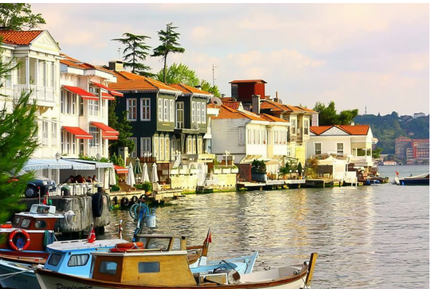
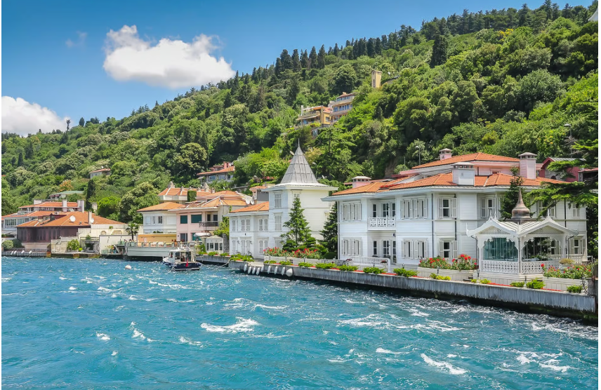
The function of the archipelago shifted dramatically during the late nineteenth century. Wealthy Ottoman citizens, along with large Greek, Armenian, and Jewish merchant communities, began purchasing plots of land to construct summer retreats. These residents introduced distinct architectural styles to the islands. The resulting structures heavily feature ornate wooden facades, wrap-around balconies, and highly detailed Victorian-era woodwork. The lack of industrial development and heavy vehicle traffic allowed these delicate wooden mansions to survive the rapid urbanization that leveled similar neighborhoods across mainland Istanbul. Today, the streets present a continuous line of historical domestic architecture preserved entirely by the strict zoning laws governing the district.
Modern Transit And The Shift To Electric Infrastructure
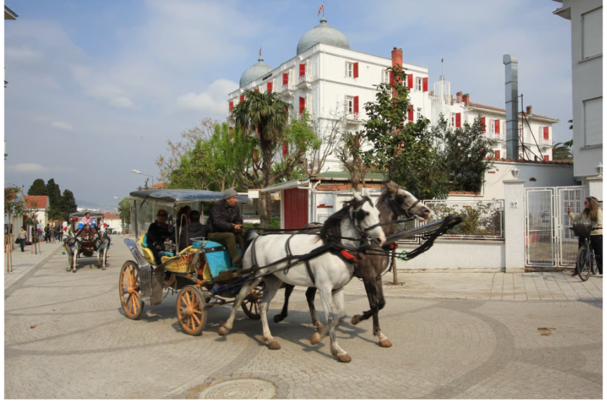
Internal combustion engines remain strictly banned across the entire archipelago. The only exceptions apply to municipal service vehicles, police cars, and emergency medical transports. For over a century, horse-drawn carriages, known locally as phaetons, operated as the primary transit method for both residents and tourists.
A severe outbreak of the glanders disease in 2019 forced the local government to reassess this system. Animal rights groups had long criticized the heavy physical toll placed on the horses during peak summer months. The Istanbul Metropolitan Municipality intervened, executing a complete ban on all horse-drawn carriages in 2020. The city replaced the physical animals with a fleet of electric vehicles. Small electric buses, designed to handle the steep inclines of the island roads, now run continuous loops between the ferry terminals and the higher residential neighborhoods. Visitors can hire private electric taxis, called AdaTaksi, for direct routes. The primary method of independent movement relies heavily on bicycle rentals. Hundreds of shops near the ferry docks maintain large fleets of single and tandem bicycles, allowing travelers to ride the wide, paved coastal circuits at their own pace.
Büyükada: Evaluating The Primary Hub
Büyükada holds the title of the largest and most heavily trafficked island in the chain. The ferry terminal anchors the primary commercial zone, feeding visitors directly into a dense network of seafood restaurants, ice cream vendors, and bicycle rental operations. The topography of Büyükada features two massive hills separated by a central valley. This elevation change requires significant physical exertion from visitors attempting to cross the island on foot or on a bicycle.
The southern peak holds the Greek Orthodox Church of St. George, known as Aya Yorgi. Reaching this structure involves a steep, continuous climb through dense pine forests. The view from the church courtyard offers an unobstructed line of sight across the water to the Asian side of the city. The northern section of the island features the massive wooden frame of the Prinkipo Greek Orthodox Orphanage. Built in 1898, this six-story structure ranks as the largest wooden building in Europe. The building remains entirely abandoned, slowly deteriorating under the harsh maritime weather conditions. The massive scale of the rotting timber serves as a stark visual record of the former demographic diversity that once defined the island communities.
Heybeliada And Burgazada: The Lower Density Alternatives
Travelers researching our European travel guides frequently search for destinations that bypass the heaviest tourist concentrations. Heybeliada and Burgazada fulfill this exact requirement. Heybeliada acts as the second-largest landmass in the chain. The defining feature of this island is the massive hilltop structure of the Halki Theological Seminary. This Greek Orthodox institution operated as the primary theological school for the Eastern Orthodox Church until the Turkish government ordered its closure in 1971. The buildings and the immaculate surrounding gardens remain maintained, offering a quiet architectural diversion away from the busy port areas.
Burgazada scales down the environment even further. A single prominent hill dominates the center of the island. The commercial footprint near the docks remains minimal, restricted to a few bakeries and quiet cafes overlooking the water. The writer Sait Faik Abasıyanık spent significant time living and writing on Burgazada. His former residence now operates as a small museum dedicated to his work. The coastal perimeter features rocky outcroppings and small pebble beaches where locals swim during the hot summer months. The noise levels on Burgazada drop to near absolute silence once visitors walk a few hundred meters away from the main ferry landing.
Maritime Logistics And Ferry Operations
Accessing the archipelago requires coordinating with the massive Istanbul maritime transit network. Two distinct operational models manage the crossing. The official municipal ferry system, operated by Şehir Hatları, provides the most reliable and cost-effective transit method. These large, multi-deck vessels depart from major hubs like Eminönü, Beşiktaş, and Kabataş on the European side, making stops at Kadıköy and Bostancı on the Asian side before crossing the open water to the islands.
Private operators like Turyol and Dentur run smaller, faster boats during the peak summer season. These private lines often command a higher ticket price in exchange for a slightly reduced crossing time. Using a standard Istanbulkart transit card allows passengers to simply tap through the municipal turnstiles without waiting in physical ticket lines. The maritime crossing takes roughly ninety minutes from the European ports to Büyükada. The open-air decks provide excellent vantage points for photographing the shifting skyline of the city as the boat pulls away from the mainland.
The weather dictates the reliability of the ferry schedules. High winds and dense fog across the Sea of Marmara frequently force the port authorities to cancel all departures. Checking the maritime weather forecasts the night before a planned crossing prevents travelers from arriving at closed terminal gates. Managing these transit variables guarantees a highly successful exploration of this unique, motor-free environment just off the coast of the Turkish capital.