
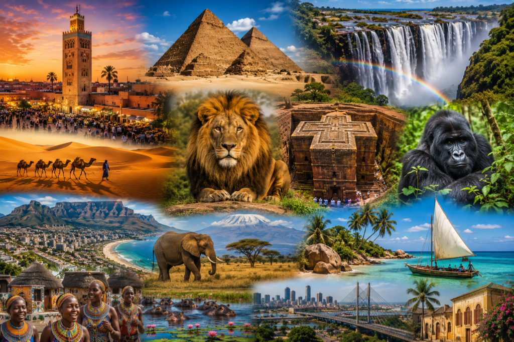
Africa’s Top Tourist Attractions: Morocco to Mozambique
From Morocco to Mozambique: Exploring Africa’s Top Tourist Attractions
Continental Africa encompasses vast ecological zones and deep historical records. Evaluating Africa’s top tourist attractions requires dividing the landmass into distinct geographic regions. Northern historical sites offer a different value proposition compared to southern marine reserves, central geological formations, or high-altitude rainforests. Analyzing these locations demands a fact-based approach to geography, local infrastructure, and seasonal climate patterns. Reviewing comprehensive international travel guides allows travelers to match specific schedules with optimal regional conditions.
Northern Points: Moroccan Historical Architecture
Morocco anchors the northwestern edge of the continent. The Atlas Mountains create a physical barrier between the coastal Mediterranean climate and the harsh Sahara Desert. Marrakech functions as a historical trading hub within this geographic transition zone. The central Medina operates as an active economic center surrounded by centuries-old defensive walls constructed from local earth and water.
The architecture features distinct Islamic geometric patterns and fortified red clay structures. The physical layout consists of narrow pedestrian alleys that dictate the flow of commerce and provide structural shade. Moving south from the urban centers reveals the shifting sand dunes of Erg Chebbi. Visiting this region requires careful temperature management during the peak summer months, pushing peak visitation to the cooler spring and autumn seasons.

Archaeological Preservation Along the Nile River
The Nile River dictates the historical and modern settlement patterns of Egypt. The Giza Plateau sits on the edge of the western desert, housing the Great Pyramids and the Sphinx. These limestone and granite structures demonstrate advanced ancient engineering and precise astronomical alignment. Dry desert conditions have facilitated the preservation of these monuments over millennia.
Modern infrastructure connects Cairo directly to southern archaeological sites in Luxor and Aswan. River cruisers provide a logistical solution for observing the continuous string of temples along the riverbanks. High summer temperatures make archaeological site visits physically demanding. Scheduling trips between November and March guarantees cooler weather for extended outdoor exploration.
Primate Conservation in the Virunga Massif
The Virunga Massif extends across the borders of Rwanda, Uganda, and the Democratic Republic of the Congo. Rwanda’s Volcanoes National Park protects a significant portion of this high-altitude rainforest. The dense vegetation and mountainous terrain provide the primary habitat for endangered mountain gorillas. Tracking these primates requires physical stamina to negotiate steep, muddy trails through thick bamboo forests.
The Rwandan government implements astrict permit system to fund conservation and limit human impact on the gorilla groups. Revenue directly supports veterinary monitoring and local community development programs. The equatorial climate guarantees rain year-round, making waterproof gear a permanent requirement. The drier months from June to September present the most stable trekking conditions.
East African Wildlife Conservation Corridors
The central latitudes contain the most recognized wildlife reserves on the continent. TheSerengeti National Park in Tanzania supports the largest terrestrial mammal migration globally. Millions of wildebeest and zebras move across the plains in a continuous search for water and fresh grazing land. The timing of this movement correlates directly with regional rainfall patterns and localized vegetation growth.
Conservation efforts in East Africa rely heavily constructured tourism revenue. Managed park fees fund anti-poaching units and local community initiatives. Visitors interact with the environment through regulated safari vehicles driven by certified regional experts. Consulting Lonely Planet Africa travel resources provides exact data on park entry requirements and seasonal migration tracking.
Geological Scale at Victoria Falls
Bordering Zambia and Zimbabwe, Victoria Falls represents a massive tectonic fracture in the Earth’s crust. The Zambezi River plunges directly into a deep basalt gorge, creating a localized rainforest microclimate supported by continuous water spray. The sheer volume of water creates a visible vapor column reaching hundreds of meters into the air.
Helicopter surveys provide a clear assessment of the geological fault lines extending through the surrounding plateau. Ground-level infrastructure includes paved trails leading to various observation points along the gorge edge. Water levels dictate the intensity of the falls, peaking between February and May following the regional wet season. Lower water periods allow access to natural rock pools situated near the edge of the drop.
Arid Ecology of the Namib Desert
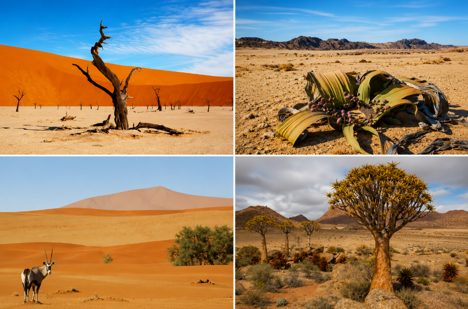
The Namib Desert stretches along the Atlantic coast of southern Africa. Wind patterns over millions of years have shaped the massive iron-rich sand dunes of Sossusvlei, creating some of the highest dunes on the planet. The Deadvlei clay pan sits among these dunes, featuring dark, petrified camel thorn trees contrasting against the white clay floor and orange sand.
Survival in this hyper-arid environment depends on a regular morning fog rolling in from the cold Atlantic Ocean. This moisture sustains specialized flora and desert-adapted wildlife, such as oryx and springbok. Travel distances between destinations require reliable four-wheel-drive vehicles and careful fuel management. Clear skies provide optimal conditions for astrotourism, with designated dark sky reserves offering unobstructed astronomical viewing.
The Mozambican Coastline and Marine Ecosystems
Mozambique occupies a long stretch of the southeastern coastline along the Indian Ocean. The marine environment here differs drastically from the inland plains. The Bazaruto Archipelago contains protected coral reefs supporting diverse aquatic populations. Strict fishing regulations protect endangered species like dugongs, manta rays, and sea turtles.
Inland, Gorongosa National Park demonstrates successful post-conflict ecological restoration. Scientists track recovering populations of lions, elephants, and wild dogs across the Great Rift Valley floodplain. The local wet season from December to April often limits road access and disrupts ground transport. Dry season visits offer stable game viewing and clearconditions for underwater observation.
Regional Climate and Seasonality Comparison
| Destination Region | Primary Attraction | Climate Zone | Optimal Travel Window |
| Morocco (North) | Historical Medinas | Mediterranean / Desert | March – May |
| Egypt (Northeast) | Ancient Monuments | Arid Desert | November – March |
| Rwanda (Central) | Primate Trekking | Equatorial Rainforest | June – September |
| Tanzania (East) | Terrestrial Migration | Tropical Savanna | June – October |
| Zambia / Zimbabwe | Geological Formations | Subtropical | February – May |
| Namibia (Southwest) | Desert Landscapes | Hyper-Arid | May – October |
| Mozambique (South) | Marine Reefs / Safaris | Tropical Coastal | May – November |