
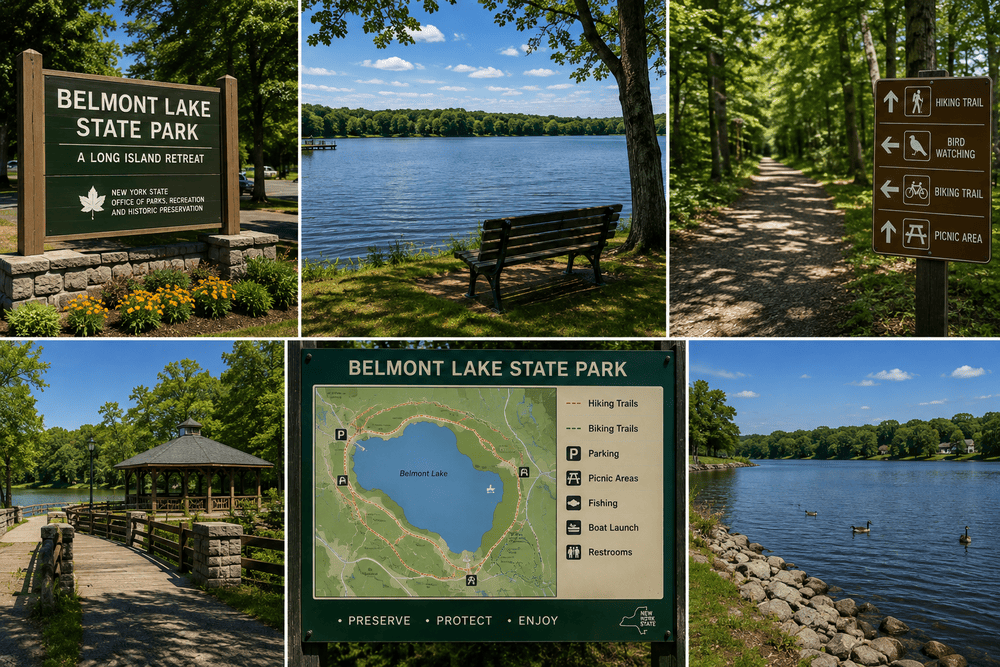
Belmont Lake State Park anchors the recreational infrastructure of North Babylon in Suffolk County, New York. The 463-acre property functions as the administrative headquarters for the Long Island region of the New York State Office of Parks, Recreation and Historic Preservation. Evaluating its nineteenth-century equestrian history, the modern hydrological management of the lake, and the surrounding trail networks provides a clear framework for analyzing this high-volume public space.
The August Belmont Equestrian Estate
The physical footprint of the modern park originates from a massive private landholding. Financier August Belmont Jr. inherited and expanded the property originally purchased by his father in 1867. The family established a 1,300-acre equestrian facility known as the Nursery Stud Farm. Belmont operated as a dominant force in American thoroughbred racing. He founded the Belmont Stakes and bred the legendary racehorse Man o’ War directly on this Long Island property.
Belmont utilized the immense wealth generated from his banking empire to fund this rural retreat. He financed the construction of the original New York City Subway line through the Interborough Rapid Transit Company in 1902. He backed the construction of the Cape Cod Canal in Massachusetts. The financial yields from these massive infrastructure projects allowed him to maintain a private mansion, extensive stables, a horse racing track, and a heavily managed trout pond on the Babylon estate. The rural isolation provided a direct escape from the heavy industrial operations of his Manhattan corporate offices.

The Robert Moses Era And Police Headquarters
The transition from private estate to public park occurred under the strict direction of Robert Moses. Serving as the President of the Long Island State Park Commission, Moses secured the purchase of the Belmont property in 1926. The state demolished the aging mansion a decade later in 1936. Moses replaced the private luxury structures with public utility buildings and vast picnic grounds.
The administration selected this exact location to serve as the regional headquarters for the newly formed park system in 1935. It provided a centralized, secure location to coordinate rapid development across Long Island. The site functioned as the primary headquarters for the Long Island State Parkway Police until 1980. The physical buildings constructed during this period reflect the heavy masonry and functional design favored by New York State engineers during the mid-twentieth century. Today, the park continues its administrative function, housing the regional offices that oversee dozens of massive state parks stretching from the Queens border to Montauk Point.
Hydrological Operations And Recreational Fishing
The central geographic feature of the park is Belmont Lake. This 19-acre water body presents a highly uniform, shallow profile. The depth maxes out at just four feet. The New York State Department of Environmental Conservation actively manages the aquatic ecosystem to support high-volume recreational fishing.
The shallow depth prevents the lake from sustaining trout populations through the extreme heat of mid-summer. To counter this thermal limitation, the state executes a heavy stocking program every spring. Hatchery trucks deposit brown, brook, and rainbow trout into the water, generating an immediate seasonal fishing surge. The state and the park administration jointly host a massive Family Fishing Festival every April to capitalize on this freshly stocked inventory.

The lake holds a permanent population of warm-water species. Fishermen routinely target large common carp and yellow perch. Recent state surveys indicate a highly productive largemouth bass environment. DEC biologists recorded catch rates for bass exceeding fifteen inches in length that rank among the highest of any waterbody on Long Island.
| Fish Species | Management Strategy | Seasonal Availability |
| Brown Trout | Spring stocking program | Spring |
| Largemouth Bass | Natural reproduction | Year-round |
| Common Carp | Natural reproduction | Year-round |
| Yellow Perch | Natural reproduction | Year-round |
Aquatic Operations And Boating Infrastructure
The state restricts aquatic access to protect the small lake from overcrowding and environmental degradation. Private motorized vessels face a total ban. The park operates a dedicated boat house on the eastern shore, providing a rental fleet of rowboats, pedal boats, and kayaks. This rental operation runs strictly on weekends starting Memorial Day, shifting to a daily schedule from late June through early September.
Visitors launching private non-motorized boats must wait until the boat house is actively manned by state personnel. The complete absence of heavy boat wakes preserves the shoreline from mechanical erosion. The restriction maintains a calm surface for novice kayakers and families operating pedal boats. The tree line extends directly to the water’s edge, offering deep shade during the summer months. Ospreys hunt across the open water, plunging from high altitudes to extract small fish from the shallow basin.

Evaluating The Trail Network And Carll’s Creek
The land surrounding the lake features nearly eight miles of multi-use trails. The route network spreads deep into the 463-acre property, providing a quiet buffer against the surrounding suburban grid. A primary 3.8-mile path traces the banks of Carll’s Creek. This exact corridor pushes straight south, connecting Belmont Lake directly with Argyle Lake in the neighboring village. The terrain remains entirely flat. The walking surfaces consist of packed dirt and paved asphalt, removing any requirement for technical hiking gear.
The state permits horseback riding across designated dirt paths. This zoning maintains a direct operational link to the original equestrian history of the Nursery Stud Farm. The paved segments support heavy bicycle traffic and stroller access, drawing massive weekend crowds from the surrounding Babylon and Bay Shore communities. Visitors building broad U.S. travel itineraries often use this park as a low-impact recovery location between visiting the high-density ocean beaches on the southern shore.
Logistical Planning And Highway Integration
Reaching the park requires minimal navigational effort. The property integrates directly into the Long Island highway system. Exit 38 on the Southern State Parkway funnels traffic straight into the main parking lots bordering the lake. This immediate highway access eliminates the friction of driving through dense residential neighborhoods to reach the entry gates.
The state charges a standard vehicle use fee during peak seasonal operations. The revenue from these entry tolls supports the continuous maintenance of the picnic pavilions, the modern playgrounds, and the heavily used public restrooms. The sheer size of the parking infrastructure accommodates thousands of daily visitors during holiday weekends. To verify current boat rental schedules, fishing regulations, and parking fees, visitors rely on the live updates provided by the official New York State Parks administrative directory. Belmont Lake State Park stands as a highly efficient recreational hub, balancing the historical legacy of a nineteenth-century estate with the heavy operational demands of a modern suburban population.