
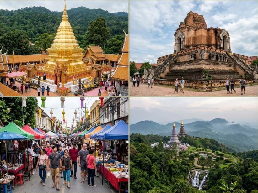
Chiang Mai operates as the primary economic and cultural engine of Northern Thailand. Founded in 1296 by King Mengrai, the city originally functioned as the capital of the independent Lanna Kingdom. The geographical positioning dictates its historical and modern significance. The settlement sits in a wide, fertile valley along the banks of the Ping River, flanked by massive granite mountain ranges. This location provided natural defensive advantages and supported heavy agricultural production for centuries. Modern developers expanded the urban grid far beyond the original medieval boundaries. The city now balances its heavy reliance on international tourism with strict preservation mandates protecting hundreds of ancient religious structures. Evaluating the medieval hydrological defenses, the specific architectural engineering of the Lanna temples, and the severe seasonal weather logistics provides a clear framework for analyzing how this northern hub functions today.
The Old City Moat And Defensive Infrastructure
The original urban planners engineered a strict geometric grid to protect the Lanna capital from Burmese invasions. The Old City occupies a perfect square measuring roughly 1.5 kilometers on each side. A continuous brick wall surrounded this perimeter, reinforced by a massive exterior water moat. The defensive strategy relied on forcing enemy troops into choke points at the four primary gates. Tha Phae Gate on the eastern wall remains the most structurally intact entrance, serving today as a major pedestrian plaza and commercial landmark.
The preservation of this medieval water system creates severe modern traffic friction. The moat dictates the flow of vehicles through the urban core. Commuters must drive through a system of one-way multi-lane roads running parallel to the water. Crossing into the Old City requires utilizing narrow concrete bridges built directly over the original defensive choke points. During peak morning and evening hours, the volume of motorbikes and heavy commercial trucks overwhelms these limited entry vectors. The municipal government relies heavily on automated traffic lights at the moat corners, forcing drivers into long, static holding patterns. The original engineering succeeded in keeping foreign armies out; the modern result traps heavy vehicular congestion strictly along the perimeter.
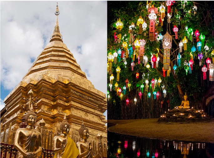
The maintenance of the moat water requires constant mechanical intervention. The city operates heavy aeration pumps to prevent stagnation and algal blooms. During the annual Songkran festival in April, the municipality treats the moat with heavy chemical filtration. Millions of residents and tourists use buckets to pull water directly from the moat to flood the streets during the massive city-wide water fight. The sheer volume of people interacting with the municipal water supply forces the government to execute strict hygiene protocols weeks before the event begins.
Lanna Architectural Engineering And Temple Density
The concentration of Buddhist sites within the Old City limits remains staggeringly high. The municipality maintains over three hundred active temple complexes, known as wats. The structural design of these buildings relies entirely on the classical Lanna architectural style. The builders utilized heavy teak wood for the primary structural supports, carving intricate floral patterns directly into the pillars and roof gables. The roofs feature steep, multi-tiered overlapping panels designed to shed the massive volume of water generated by the tropical monsoon season.
Wat Chedi Luang dominates the exact geographic center of the Old City. Construction on this massive brick stupa began in the 14th century. At its peak, the structure reached 82 meters in height, functioning as the tallest building in the entire Lanna Kingdom. A severe earthquake struck the region in 1545, collapsing the top thirty meters of the spire. The Thai Fine Arts Department executed a massive structural stabilization project in the 1990s. The engineers chose to reinforce the exposed brick core with modern cement rather than rebuilding the missing peak, preserving the ruined silhouette as a permanent historical record of the seismic event. The sheer physical mass of the surviving square base dictates the layout of the surrounding neighborhood, forcing modern roads to curve sharply around the ancient foundations.
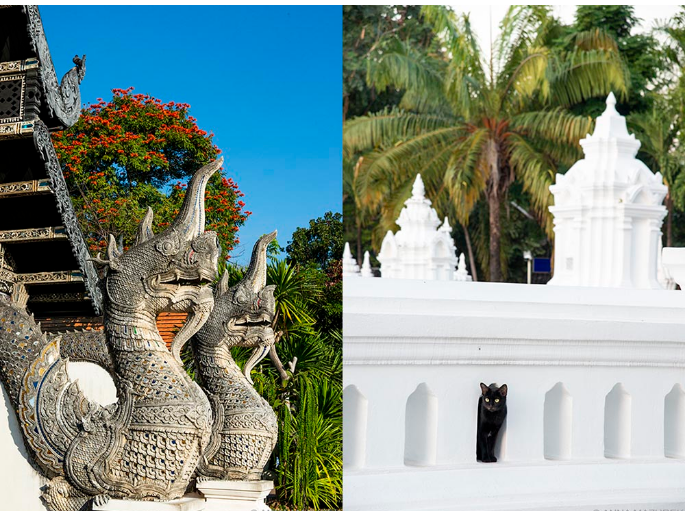
Just a few blocks west, Wat Phra Singh provides a pristine example of intact Lanna engineering. The complex houses the Phra Singh Buddha statue, drawing high volumes of domestic religious pilgrims. The main assembly hall features thick, slanted exterior walls. The builders sloped the masonry inward to support the immense weight of the heavy timber roof. The interior walls display extensive gold leaf murals documenting the regional clothing, agricultural practices, and social hierarchies of northern Thailand during the 19th century.
Wat Chiang Man sits in the northeastern corner of the square, holding the title of the oldest temple inside the city walls. The foundation of the primary stupa features life-sized stone elephants emerging from the base. The complex houses the Crystal Buddha, a tiny quartz statue heavily protected behind thick glass and iron bars. The continuous physical upkeep of these wooden and stone structures requires a permanent workforce of highly trained artisans capable of replacing rotting teak panels without compromising the structural integrity of the centuries-old buildings.
| Temple Name | Primary Architectural Feature | Historical Significance |
|---|---|---|
| Wat Chedi Luang | Massive ruined brick stupa | Former home of the Emerald Buddha |
| Wat Phra Singh | Slanted exterior assembly walls | Houses the Phra Singh Buddha |
| Wat Chiang Man | Elephant-flanked stone base | Oldest temple inside the city walls |
| Wat Phra That Doi Suthep | Golden central spire, 309-step Naga stair | Contains a verified relic of the Buddha |
Doi Suthep And Topographical Dominance
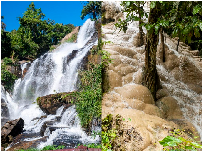
The physical geography of the entire Chiang Mai valley relies on the imposing presence of Doi Suthep. This massive granite peak rises 1,676 meters directly above the western edge of the city. The mountain acts as a permanent visual anchor, visible from almost every major intersection in the urban grid. The extreme elevation change dictates localized weather patterns, catching heavy rain clouds during the wet season and funneling cooler air down into the valley floor overnight.
The mountain supports Wat Phra That Doi Suthep, one of the most significant religious sites in the country. The temple sits at an elevation of 1,073 meters. Prior to 1935, reaching the site required a punishing five-hour vertical hike through dense jungle. Kruba Srivichai, a highly influential monk, organized thousands of volunteer laborers to cut a steep, winding asphalt road directly up the eastern face of the mountain. This engineering feat reduced the transit time to just forty minutes.
Modern visitors reach the base of the temple complex and face a massive Naga staircase featuring 309 stone steps. The steep incline forces a slow, deliberate ascent, operating as a physical purification ritual before entering the inner sanctuary. The central golden stupa houses a verified relic of the Buddha, drawing massive crowds on religious holidays. The outer terrace of the temple functions as an aerial observation deck. On clear days, the entire 1.5-kilometer square of the Old City moat remains perfectly visible below, allowing observers to comprehend the sheer scale of the modern urban sprawl pushing outward toward the provincial borders. The dense forest covering the mountain forms the Doi Suthep-Pui National Park, providing a massive protected green space that completely blocks western residential expansion.
Culinary Operations And Regional Agriculture
The food systems in Chiang Mai differ completely from the seafood-heavy, coconut-based menus found in southern Thailand. The northern climate and mountainous terrain dictate a highly specific agricultural output. The regional diet relies heavily on glutinous sticky rice, bitter forest herbs, and heavy pork consumption. The geographic isolation of the Lanna Kingdom allowed a distinct culinary profile to develop, heavily influenced by historical trade routes connecting Myanmar, China, and Laos.
Khao Soi operates as the primary culinary export of the city. The dish consists of soft egg noodles submerged in a heavy, meat-based curry broth, topped with a cluster of deep-fried crispy noodles. The preparation requires boiling the broth for hours to break down the tough cuts of beef or chicken. Warorot Market, located on the banks of the Ping River, functions as the central logistical hub for these regional ingredients. The market opens before dawn, processing tons of fresh produce, dried spices, and heavy ropes of Sai Oua, a local pork sausage heavily spiced with lemongrass and galangal.
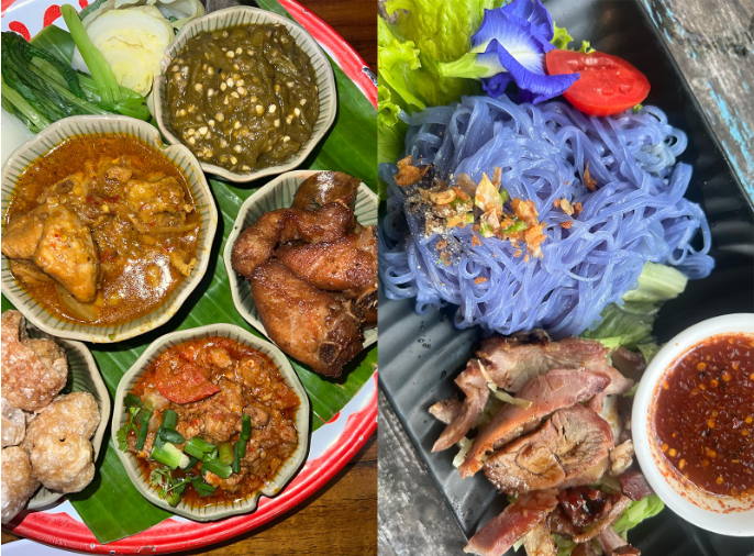
The high-end dining sector actively leverages this regional agricultural heritage. Chefs execute highly technical tasting menus utilizing foraging networks deep in the surrounding mountain villages. For independent baseline data on the exact ratings of these specific kitchens, the Michelin Guide provides extensive evaluations of the complex plating and service standards utilized by the local culinary staff. The global recognition of the northern flavor profile drives heavy culinary tourism, supporting hundreds of independent cooking schools and organic farm tours operating on the outskirts of the city.
Air Quality Logistics And The Burning Season
Executing a successful operational schedule in Chiang Mai requires tracking severe seasonal weather and air quality patterns. The climate operates on a harsh cycle that produces a distinct phenomenon known locally as the “burning season.” The Chiang Mai valley functions geographically as a massive bowl. The high granite mountains form the walls, trapping the air directly over the city center.
From late February through April, regional farmers across northern Thailand and neighboring Myanmar execute controlled agricultural burns. They set fire to their fields to clear crop residue and forage for wild mushrooms in the surrounding forests. The smoke from millions of acres of burning biomass drifts directly into the Chiang Mai valley. The topographical bowl prevents the wind from clearing the particulate matter. The PM2.5 pollution levels frequently spike to hazardous concentrations, turning the sky a flat, hazy gray and completely obscuring Doi Suthep from view.
The severe reduction in air quality dictates the local economy during these months. Expatriates and digital nomads routinely relocate to the southern islands to avoid respiratory distress. The municipal government mandates work-from-home orders during the most hazardous weeks. Aviation operations suffer direct logistical hits. The thick smoke drastically reduces runway visibility, forcing commercial pilots to execute complex instrument landings or divert flights back to Bangkok. Travelers building broad Asia travel itineraries must evaluate these barometric and environmental conditions, recognizing that late spring visits require N95 particulate masks and indoor, climate-controlled accommodations. The arrival of the heavy monsoon rains in May finally breaks the cycle, washing the particulate matter out of the atmosphere and returning the air quality to safe levels.
Aviation Infrastructure And Regional Connectivity
Chiang Mai International Airport (CNX) operates as the primary gateway to northern Thailand. The facility sits just three kilometers southwest of the Old City walls. The immediate proximity to the urban core creates severe operational constraints. The airport relies on a single runway measuring 3,100 meters, capable of handling widebody jets like the Boeing 777 and Airbus A330.
The single runway limits the total number of hourly flight movements. The physical location prevents the construction of a parallel runway. The surrounding residential neighborhoods enforce a strict nighttime curfew. The aviation authorities prohibit commercial flight operations between midnight and 6:00 AM to mitigate severe noise pollution over the sleeping city. This curfew forces airlines to compress their daily schedules into a tight eighteen-hour window. The domestic market dominates the arrival boards, with dozens of daily narrowbody flights connecting CNX directly to the dual aviation hubs in Bangkok. The international terminal processes a high volume of direct flights from South Korea, Taiwan, and mainland China, completely bypassing the capital to deliver tourists straight into the northern highlands.
The limited taxiway infrastructure forces departing aircraft to wait at the runway thresholds while arriving planes clear the active tarmac. This creates compounding delays during the evening push. The national government recently acquired land in a neighboring province to construct a massive secondary airport. The proposed Lanna International Airport project aims to absorb the overflow traffic and allow twenty-four-hour cargo operations. The current CNX facility faces maximum capacity during the peak winter months, creating heavy passenger bottlenecks at the security checkpoints and limited baggage claim carousels.