
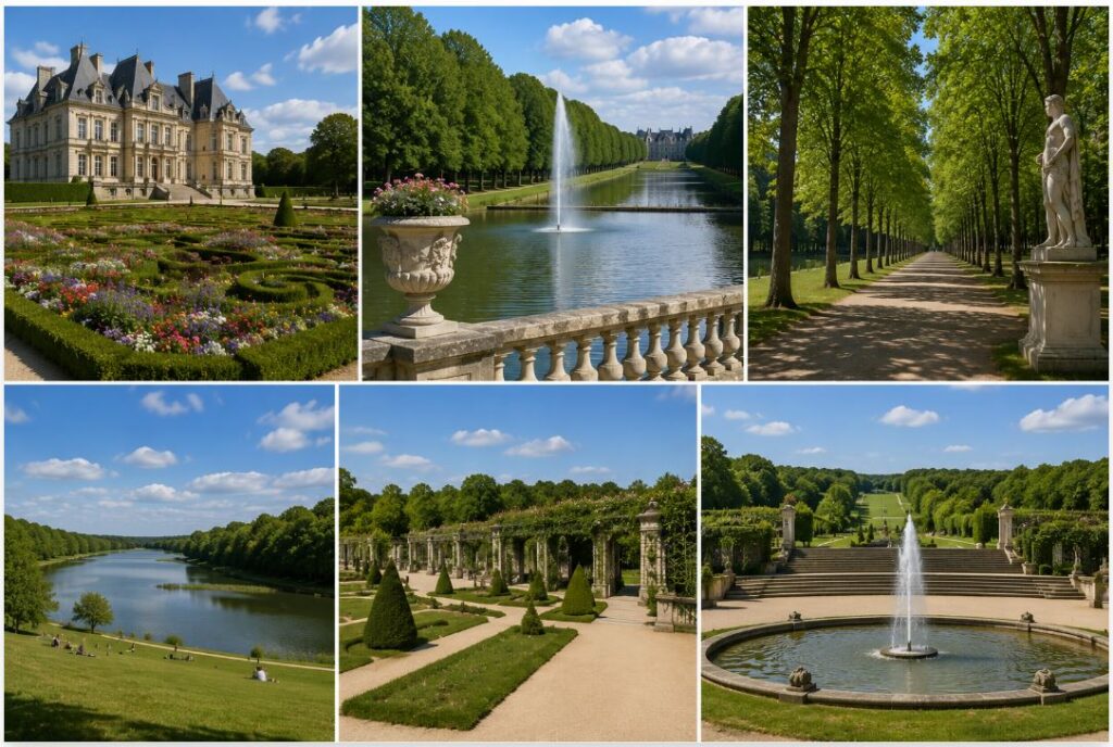
The southern suburbs of Paris contain one of the most structurally significant green spaces in France. Located in the Hauts-de-Seine department, Parc de Sceaux covers 181 hectares of highly engineered terrain. The site offers a direct counterpoint to the heavy tourist concentration at Versailles. By evaluating the formal geometry of the gardens, the massive hydrological infrastructure, and the seasonal blooming cycles, travelers gain a clear read on how this classical French park operates as a major cultural asset just outside the capital.
The Historical Framework And Le Nôtre Design
The current physical layout traces its origins directly to the late seventeenth century. Jean-Baptiste Colbert, the powerful minister of finance under King Louis XIV, purchased the estate in 1670. Colbert wanted a property that projected extreme political authority and financial wealth. He hired André Le Nôtre, the principal gardener of the King, to impose strict order on the surrounding terrain.
Le Nôtre applied the rigid principles of the French formal garden. He manipulated the topography to create long, sweeping optical illusions. The central axis of the park runs for miles, lined with perfectly parallel rows of pruned trees. This geometric precision forces the human eye to perceive the property as infinitely larger than its actual borders. The design rejects natural, wild growth in favor of absolute mathematical control over nature. The trees undergo strict pollarding, a pruning technique that maintains flat, uniform canopies across massive stretches of the estate.
The French Revolution dismantled the original grandeur of the property. The state confiscated the land, and the primary castle faced complete demolition by developers selling the raw building materials. The grounds fell into ruin for decades. The park visitors see today represents a massive restoration effort initiated in the 1920s by local government authorities, who repurchased the land and systematically rebuilt the lost geometric corridors.

Hydrological Engineering And The Grand Canal
Water functions as the primary organizational tool across the entire property. The original planners faced a severe geographic constraint. The site lacked a high-volume natural river to feed the required fountains and reflection pools. Engineers solved this issue by constructing a massive network of underground aqueducts to capture regional runoff and channel it into the central basins.
The focal point of this water system is the Grand Canal. Measuring over one kilometer in length, this massive artificial waterway cuts a deep cross-axis through the lower section of the park. The canal serves a dual purpose. It acts as an enormous mirror, reflecting the sky and the surrounding tree lines to increase the visual depth of the property. It functions as an active drainage reservoir that prevents the flat lawns from flooding during heavy spring rainfalls.
Visitors walking the perimeter of the canal observe the cascading waterfalls of the Octagon Basin. The water drops over a series of stone steps, generating constant ambient noise that masks the sounds of the surrounding suburban traffic. The maintenance of this system requires heavy mechanical intervention. The Hauts-de-Seine departmental council manages the continuous dredging and water quality testing required to prevent algae blooms from choking the artificial basins during the hot summer months.

Seasonal Variations And The Cherry Blossom Phenomenon
The botanical profile of the park changes drastically based on the season. The standard aesthetic relies on the dark greens of oak, chestnut, and hornbeam trees. The month of April introduces a radical color shift. The park holds one of the largest concentrations of cherry trees in Europe, drawing massive regional crowds.
The property features two distinct orchards. The Bosquet Nord contains dozens of white cherry trees, creating a bright, snowy canopy over the northern lawns. The Bosquet Sud generates the heavier foot traffic. This southern grove holds over one hundred pink Prunus serrulata trees. When these trees reach peak bloom, the entire section turns a blinding shade of magenta.

The local Japanese expatriate community utilizes this specific grove to celebrate Hanami, the traditional custom of viewing flowers. Families lay out massive tarps beneath the branches, turning the area into a high-density picnic zone. The bloom lasts for a maximum of two weeks. Wind and rain dictate the exact duration of the display. Visitors attempting to time their trips to match the pink canopy must monitor local botanical reports, seeing that the peak window shifts by several days every year depending on the severity of the preceding winter.
The Chateau Architecture And Museum Operations
The central building anchoring the property does not date back to the Colbert era. Following the destruction of the original seventeenth-century structure, the Duke of Treviso constructed the current Chateau de Sceaux in the middle of the nineteenth century. The architects utilized a Louis XIII revival style, combining red brick facades with heavy stone quoins and a steeply pitched slate roof.
The building functions entirely as a public museum today. The Musée du Domaine départemental de Sceaux houses an extensive collection of paintings, ceramics, and furniture documenting the history of the Paris region from the seventeenth century to the mid-twentieth century. The curators rotate exhibitions to focus on regional urban planning, historical garden design, and the lives of the various aristocratic families that occupied the estate.
Access to the museum requires an entry fee, making the surrounding parklands entirely free to the public. The former stables, known as the Orangerie, sit just east of the main castle. This long, stone gallery features massive arched windows designed to capture winter sunlight and protect delicate citrus trees from frost. The municipality now uses this historic hall to host classical music concerts, taking advantage of the high stone ceilings and excellent acoustic properties.

Regional Transit Logistics And Paris Integration
Reaching the estate requires a basic grasp of the Paris regional transit network. The property sits roughly ten kilometers south of the city center. Driving a private vehicle creates unnecessary friction. Parking lots near the entrance gates fill to absolute capacity by mid-morning on weekends. The RER B train line offers the most efficient access corridor.
Passengers departing from central stations like Châtelet-Les Halles or Saint-Michel Notre-Dame reach the park in less than thirty minutes. The train line features two distinct stops servicing the property. The Parc de Sceaux station drops visitors near the eastern gates, requiring a short walk through a quiet residential neighborhood. The Croix de Berny station positions travelers closer to the southern end of the Grand Canal.
Travelers building broad Europe travel itineraries frequently select this destination as a half-day excursion. It delivers the massive scale and historical weight of Versailles without the crushing tourist volume. The wide, paved paths provide excellent conditions for cycling, and rental stations operate near the main entrances during the summer season. By analyzing the transit connections and tracking the seasonal botanical cycles, visitors extract maximum value from this highly engineered green space on the immediate edge of the French capital.