

Analyzing Chile’s Premier Alpine Environment
Torres del Paine National Park commands attention as the centerpiece of Chilean Patagonia. Spanning over two hundred thousand hectares, the protected area centers around a dramatic cordillera of granite spires rising directly from the steppe. Tourism operations here evolved from basic mountaineering base camps into a highly structured network of accommodations and maintained routes. Analyzing the physical layout and the strict administrative rules governing the park provides a necessary foundation for planning a successful visit to this extreme southern latitude.
The Geological Formation Of The Paine Massif
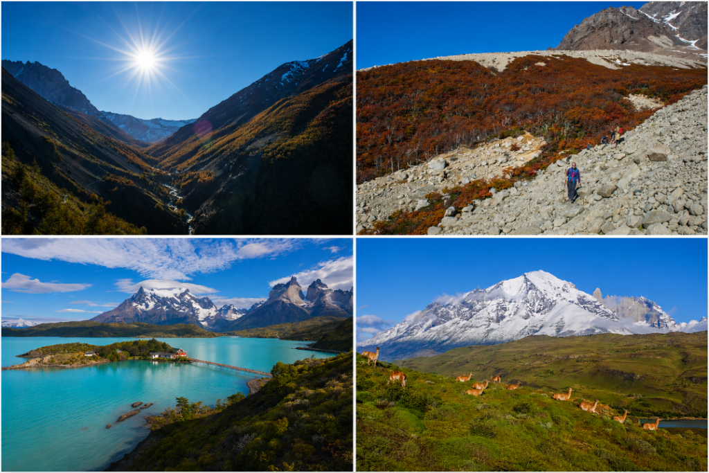
The defining feature of the park is the Paine Massif, a localized mountain group separate from the main Andes range. Millions of years of glacial erosion stripped away the softer sedimentary rock, exposing the hard granite pillars underneath. The most famous of these structures, the three massive granite towers, give the park its name. Surrounding the rock formations, the terrain features deep valleys filled with massive freshwater lakes. The distinct coloration of these lakes, ranging from deep azure to milky turquoise, results directly from suspended glacial flour ground down by the retreating ice fields. The Grey Glacier, a major outflow from the Southern Patagonian Ice Field, dominates the western edge of the park. Visitors observe massive walls of blue ice calving directly into Lago Grey, a continuous reminder of the active geological forces still shaping the region.
Analyzing The Trekking Circuits And Trail Infrastructure
The trail system inside the park operates on a fixed infrastructure model. The overwhelming majority of visitors target the “W” trek, a route covering the southern valleys of the massif over four to five days. Hikers walk up into the Ascencio Valley to view the base of the towers, cross the French Valley beneath hanging glaciers, and finish alongside the Grey Glacier. For those seeking longer exposure to the high alpine environment, the “O” circuit loops entirely around the back of the mountains. This extended route requires a heavier pack and a higher level of self-sufficiency, taking roughly eight days to complete.
The park relies heavily on private concessionaires to run the refugios located at strategic intervals along these routes. These mountain lodges provide hot meals, bunk beds, and hot showers, effectively removing the need to carry heavy tents and cooking equipment. Travelers planning their trips often consult our adventure travel guides to determine if they prefer the physical comfort of a refugio or the isolation of a backcountry campsite. The combination of demanding physical routes with access to warm beds makes the park highly attractive to a broad demographic of international hikers.
Weather Systems And Optimal Travel Windows
Meteorological conditions in southern Chile dictate every aspect of park operations. The extreme southern latitude places the park directly in the path of the Roaring Forties, powerful westerly winds sweeping across the Pacific Ocean. During the primary summer season from November to March, wind gusts regularly exceed one hundred kilometers per hour. These intense gales drop temperatures instantly and force hikers to brace themselves on exposed ridges. Rain remains a constant threat, and snow can fall at higher elevations even in January.
The concept of a stable forecast does not apply here. Hikers routinely experience bright sunshine, freezing rain, and high winds within a single afternoon. The winter months from June through August bring a complete shutdown of the main refugio network. Deep snowpack obscures the trails, and the shortened daylight hours restrict safe movement. Only highly experienced winter mountaineering teams attempt the circuits during this period. Preparing for this environment means adopting a strict layering system for clothing, prioritizing windproof and waterproof materials over heavy insulation.

Wildlife Conservation And Ecotourism Management
The massive influx of foreign visitors forced the Chilean government to implement strict management protocols to preserve the fragile topsoil and native flora. The National Forestry Corporation (CONAF) mandates that every hiker secure campsite or refugio reservations before entering the park boundaries. Rangers turn away anyone attempting to hike the multi-day circuits without proof of confirmed lodging. This quota system prevents overcrowding on the narrow trails and reduces the accumulation of human waste in remote areas.
Fire remains the single largest threat to the ecosystem. Decades ago, careless campers started massive wildfires that burned thousands of hectares of slow-growing lenga forests. The charred trunks still line the shores of Lake Pehoé. As a direct result, park authorities enforce a zero-tolerance policy regarding open flames. Visitors must cook only inside designated, three-sided shelters. Breaking these rules results in immediate expulsion from the park and severe legal penalties.

These strict measures directly benefit the local wildlife populations. The park serves as one of the best locations in South America for observing pumas in their natural habitat. The big cats hunt the large herds of guanacos grazing on the open steppe near the park entrance. Andean condors utilize the high thermal updrafts generated by the massif to scan the valleys for carrion. By limiting human impact through highly controlled trail networks, the park successfully maintains a stable predator-prey dynamic right alongside thousands of daily visitors.
| Trekking Route | Distance | Typical Duration | Infrastructure Availability |
| The “W” Trek | 71 Kilometers | 4 to 5 Days | High (Refugios, hot meals, showers) |
| The “O” Circuit | 136 Kilometers | 7 to 9 Days | Moderate (Mix of refugios and remote camps) |
| Base of the Towers | 18 Kilometers | 1 Day | Trailhead parking, visitor center |
| French Valley | 15 Kilometers | 1 Day | Catamaran access, ranger station |
Luxury Lodging And Peripheral Infrastructure
Beyond the rugged backcountry circuits, the periphery of Torres del Paine supports a thriving high-end hospitality sector. Several luxury eco-lodges operate just outside the official park boundaries, catering to guests who want to observe the granite peaks without committing to multi-day hiking. These properties utilize striking architectural designs blending directly into the grassy steppe. Many of them operate on an all-inclusive model, providing private guides, customized daily excursions, and elevated culinary programs featuring regional Chilean ingredients.
The integration of these lodges into the local economy shifted the demographic profile of the typical visitor. The region no longer relies exclusively on backpackers. The presence of premium accommodations draws a completely different segment of the travel market, injecting massive amounts of foreign capital into the nearby town of Puerto Natales. This economic shift funds better regional infrastructure, including paved access roads and upgraded airport facilities. The balance between rugged conservation and high-yield tourism creates a sustainable financial model supporting the ongoing protection of the natural environment.