
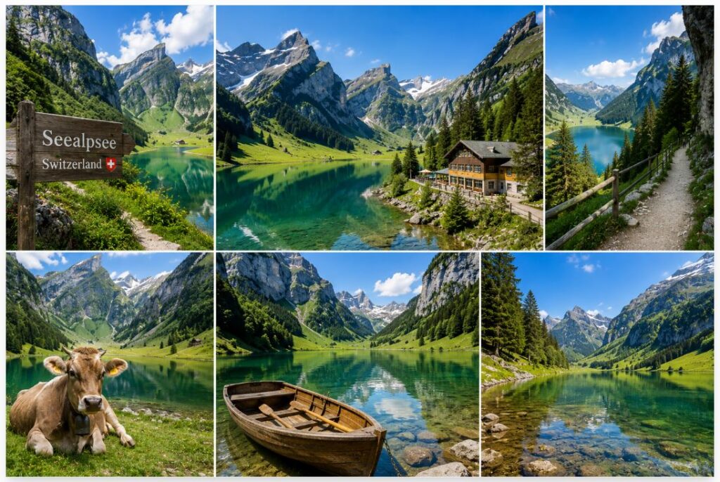
Seealpsee Lake sits deep within the Alpstein massif in the Appenzell Innerrhoden canton of Switzerland. The water body occupies a narrow glacial trough at an elevation of 1,143 meters above sea level. Flanked by steep limestone ridges, the location dictates a highly specific microclimate and restricts human access strictly to foot traffic. By analyzing the geological basin, the physical infrastructure of the trail network, and the local agricultural economy, visitors gain a clear assessment of how this high-altitude reservoir functions as a natural habitat and a major regional economic asset.
Geological Formation And Hydrology
The lake owes its existence to the retreating glaciers of the last ice age. Massive sheets of ice carved a deep depression into the limestone bedrock. Today, the basin relies entirely on snowmelt and subterranean springs pouring off the surrounding peaks to maintain its water levels. The surrounding rock consists of pure limestone. This creates a highly alkaline water composition.

The lake covers an area of roughly 13.6 hectares. The water remains incredibly cold year-round. Summer surface temperatures rarely exceed 16 degrees Celsius. The severe depth and lack of suspended sediments give the water a highly reflective, dark green appearance that mirrors the dense pine forests growing along the southern shore. The runoff from the lake feeds directly into the Schwendibach stream, flowing rapidly down the valley toward the main villages of the Appenzell district.
Wasserauen Trailhead And Physical Access
Reaching the water requires assessing the available footpaths. The primary access point sits at the Wasserauen train station, located at the end of the Appenzell railway line. From this valley floor, hikers face a sheer vertical ascent. The local authorities maintain two distinct routes connecting the valley to the lake basin.
The first route follows a paved service road. This path accommodates the small utility vehicles used by local farmers and innkeepers. The incline registers as severe, forcing a rapid elevation gain over a very short distance. The surface provides secure footing during wet conditions. The second option forces hikers into the dense forest along the Schwendibach stream. This path relies on exposed roots, loose rocks, and heavy timber stairs. The physical exertion required for either route acts as a natural filter, separating casual sightseers from prepared hikers.
| Trail Option | Starting Point | Surface Type | Physical Demand |
| Service Road | Wasserauen Station | Steep asphalt | Moderate to High |
| Forest Trail | Wasserauen Station | Dirt, roots, stone steps | High |
| Ebenalp Descent | Ebenalp Cable Car | Rocky alpine decline | Moderate |

The Perimeter Circuit And Aquatic Infrastructure
A flat walking path wraps around the entire circumference of the lake. This specific loop covers roughly 1.8 miles. Walking this circuit takes most visitors forty-five minutes. The eastern shore features dense forest coverage. The roots of ancient pine trees extend directly into the water. The western shore opens up into wide grassy pastures.
Small wooden rowboats sit tied to the docks near the inns. Visitors rent these boats by the hour to access the center of the lake. Swimming is permitted by the local authorities. The extreme cold limits most swimmers to very brief exposures. The lack of motorized watercraft preserves a silent, undisturbed surface, allowing the surrounding peaks to reflect perfectly on clear mornings.
Agricultural Operations And Raw Milk Production
The land surrounding the lake does not function simply as a scenic backdrop. It operates as an active, high-yield agricultural zone. Appenzell dairy farmers practice seasonal alpine transhumance. In the early summer, herders move their cattle up the steep trails to graze on the nutrient-dense grasses of the high pastures.
The local cows produce milk with a distinct flavor profile derived entirely from the specific alpine flora they consume. Several small dairy operations process this raw milk directly on the shores of the lake, producing regional Appenzeller cheese. The farmers store the heavy cheese wheels in cool cellars built directly into the hillside. Visitors walking the perimeter trail frequently encounter the herds blocking the paths. The deep, heavy tones of the traditional cowbells provide a constant acoustic layer to the entire valley.
Mountain Inns And Commercial Infrastructure
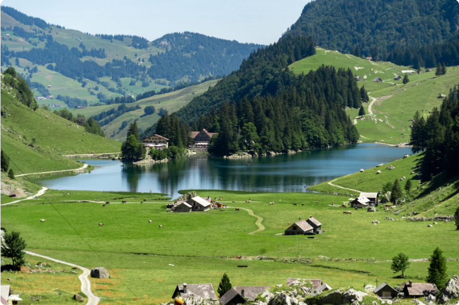
The isolation of the Alpstein region forces commercial operations to adopt highly efficient logistics. Two primary mountain inns, known locally as Berggasthäuser, operate directly on the edge of Seealpsee Lake. Berggasthaus Forelle and Berggasthaus Seealpsee offer overnight accommodations and full-service restaurants.
These facilities rely on the steep service road to import heavy supplies and export waste. Their menus center heavily on local trout pulled directly from the lake and the dairy products manufactured by their immediate neighbors. Travelers building extensive Europe travel itineraries often book rooms in these specific inns months in advance to secure the rare opportunity to experience the lake before the first train arrives in the valley and after the last day-hikers depart.
The Ebenalp And Äscher Connection
Seealpsee Lake operates as a central node in a much larger hiking network. The most famous route connects the lake to the Äscher cliff restaurant and the Ebenalp plateau. Visitors frequently utilize the Wasserauen cable car to reach the top of Ebenalp, completely bypassing the initial physical climb from the valley floor.
From the upper station, hikers descend through the Wildkirchli caves, pass the Äscher restaurant clinging to the vertical rock face, and continue down a steep, punishing trail that terminates at the edge of the lake. This specific descent places intense strain on the knees and requires specialized footwear with aggressive traction. To verify the current operating hours of the cable car and the status of the connecting trails, visitors consult the Appenzellerland Tourism administrative directory.
Geological Markers And The Säntis Peak
The visual background of Seealpsee Lake relies entirely on the imposing structure of the Säntis peak. Standing at 2,502 meters, it represents the highest elevation in the Alpstein massif. The sheer limestone walls of this mountain dominate the western sightlines from the lake shore. Geologists study this specific rock formation to track ancient tectonic shifts. The visible strata lines running across the rock face display the exact folding patterns created when the African tectonic plate collided with the Eurasian plate millions of years ago.
The physical proximity of the lake to this massive peak creates a unique wind tunnel effect. Katabatic winds rush down the steep slopes of the Säntis after sunset. This dense, cold air settles directly over the lake basin, creating heavy morning fogs that completely obscure the water until the sun rises high enough to burn off the condensation. Observing this localized weather pattern helps hikers plan their photography and climbing schedules safely.

Seasonal Weather Cycles And Risk Management
The operational window for this region remains tight. The lake sits in a deep geographical bowl that holds winter snow well into late spring. The local municipality officially closes the forest trails during the winter months. Massive snowpack accumulation creates severe avalanche risks. The steep limestone walls shed heavy amounts of snow and ice directly across the hiking paths.
The summer months bring a different set of logistical challenges. Severe afternoon thunderstorms develop rapidly over the Säntis peak. The narrow valley funnels high winds directly across the surface of the lake, dropping the ambient temperature by twenty degrees in a matter of minutes. Visitors must carry waterproof outer layers regardless of the morning forecast. Evaluating the barometric pressure and cloud formations over the western ridges acts as a required survival skill for anyone attempting the longer walks branching off from the main lake basin. Seealpsee Lake stands as a highly exposed natural asset, demanding strict logistical preparation and physical endurance from anyone attempting to explore its shores.