
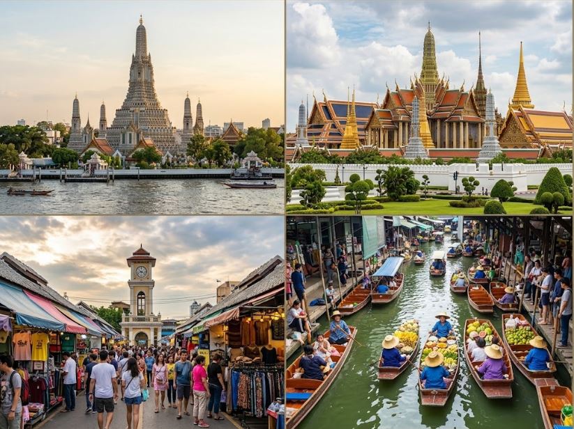
Bangkok operates as the primary economic and political engine of Thailand. Located on the delta of the Chao Phraya River, the city supports a population exceeding ten million residents. The urban layout lacks a traditional centralized grid, functioning instead as a massive sprawl of distinct districts connected by elevated tollways and heavy rail networks. Evaluating the hydrological constraints, the mass transit logistics, and the extreme density of the commercial retail sector provides a clear framework for analyzing how this city maintains its position as the dominant logistical hub in Southeast Asia.
Hydrological Realities And The Chao Phraya Basin
The geographic foundation of the city presents severe structural challenges. Engineers built Bangkok directly on top of a swampy floodplain. The Chao Phraya River bisects the urban core, creating a massive hydraulic system that dictates the physical boundaries of the oldest districts. The original city planners relied entirely on a complex network of canals, known as khlongs, to move goods and people.
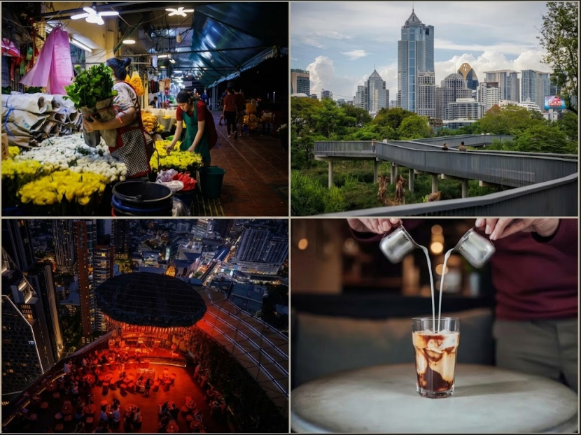
Modern developers paved over many of these waterways to construct multi-lane highways, severely reducing the natural drainage capacity of the land. The ground consists of soft marine clay. The massive weight of the concrete skyline, combined with the heavy extraction of deep groundwater by industrial operations, causes the city floor to sink several millimeters every year. The municipal government spends massive capital constructing subterranean pumping stations and elevated flood walls. This heavy infrastructure prevents the Chao Phraya from inundating the central business districts during the annual monsoon cycle.
Heavy Transit Logistics And The Rail Network
Moving human capital across this massive physical footprint requires aggressive public transit solutions. The street-level roads suffer from permanent gridlock. The government engineered the BTS Skytrain system in 1999 to bypass this friction. This heavy rail network operates entirely above the traffic, suspended on massive concrete pillars running directly down the medians of the primary commercial avenues.
The system intersects with the MRT underground network at specific transfer nodes like Asok and Sala Daeng. The integration of these two systems drastically altered the local real estate market. Property values now correlate directly to the walking distance from a station entrance. Travelers building broad Asia travel itineraries rely entirely on this rail network to move between hotels, retail centers, and historical sites, completely avoiding the severe delays associated with ground-level taxis.
| Transit Network | Infrastructure Type | Primary Coverage Area | Operational Friction |
|---|---|---|---|
| BTS Skytrain | Elevated heavy rail | Sukhumvit, Silom corridors | Peak hour platform crowding |
| MRT Blue Line | Subterranean heavy rail | Ratchadaphisek, Old City | Deep escalator transitions |
| Chao Phraya Express | River ferry network | Phra Nakhon, Riverside hotels | Seasonal water levels |
| Airport Rail Link | Elevated commuter rail | Suvarnabhumi to Phaya Thai | Baggage spatial limits |
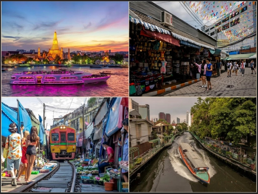
The Chao Phraya Express Boat system supplements the rail grid. These heavy diesel ferries move thousands of commuters up and down the river every day. The aquatic transit completely bypasses the highway gridlock, delivering passengers directly to the central pier at Sathorn where they transfer onto the BTS network.
Commercial Real Estate And Retail Economics
The retail sector drives a massive percentage of the local economy. The Siam and Ratchaprasong districts contain an extreme concentration of shopping malls. These structures do not function simply as retail outlets; they operate as massive, climate-controlled lifestyle centers. Facilities like CentralWorld, Siam Paragon, and IconSiam cover millions of square feet. The developers incorporate luxury automotive showrooms, massive multiplex cinemas, and high-volume food courts directly into the floor plans.
The architecture of these buildings forces consumers inside by connecting the second-floor entrances directly to the BTS Skytrain platforms via elevated walkways. This physical design allows pedestrians to walk for miles across the commercial district without ever touching the ground-level sidewalks or experiencing the severe tropical heat. Further north, the Chatuchak Weekend Market executes a completely different retail model. Spread across thirty-five acres, this massive open-air grid holds over fifteen thousand individual stalls. The logistics of supplying this market require a highly synchronized nighttime delivery schedule, moving tons of garments, ceramics, and agricultural goods through narrow alleys before the gates open to the public.
Historical Architecture On Rattanakosin Island
The political and historical weight of the nation centers on Rattanakosin Island. Bounded by the Chao Phraya River to the west and artificial defensive canals to the east, this district holds the Grand Palace and Wat Pho. The architectural engineering of these 18th-century complexes relies on high, sweeping rooflines, heavy gold leaf application, and intricate glass mosaics.
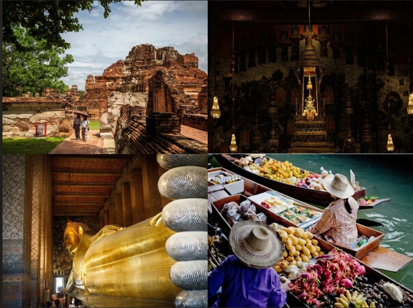
The structures project absolute royal authority. The government strictly limits vertical construction in this zone, preserving the historical sightlines and creating a stark visual contrast against the massive glass towers dominating the financial districts just a few miles away. Wat Pho houses a massive reclining Buddha statue measuring forty-six meters in length. The brick and stucco core of this statue requires continuous environmental monitoring to prevent moisture from destroying the exterior gold plating. The maintenance of these temples requires a permanent workforce of artisans trained in traditional Thai masonry and woodwork.
High-Yield Hospitality And Culinary Operations
The hospitality market in the Thai capital operates with ruthless competition. Legacy properties like the Mandarin Oriental and The Peninsula command the riverfront. These properties demand premium rates based on historical prestige and direct water access. They operate private wooden shuttle boats to move their guests across the river, maintaining total control over the transit experience. Newer high-rises in the Sukhumvit and Phloen Chit districts counter this riverfront dominance by offering hyper-modern design and immediate rail access.
The culinary operations mirror this intense stratification. The city supports thousands of street food vendors operating directly on the pavement, generating a massive informal economy. These vendors rely on fresh ingredients sourced daily from wet markets like Khlong Toei. Parallel to this, the high-end dining sector executes highly technical tasting menus that draw international scrutiny. For independent evaluations of the top-tier kitchens competing in this exact market, the Michelin Guide provides extensive data on the complex plating and service standards utilized by the local culinary staff.
Aviation Infrastructure And Global Connectivity
Bangkok connects to the global market through two distinct aviation hubs. Suvarnabhumi Airport operates as the primary international gateway, located east of the city center. The terminal architecture features a massive steel and glass canopy designed to maximize natural light and deflect thermal radiation. This facility processes the heavy widebody jets arriving from Europe and North America. The airport authorities recently completed a massive midfield satellite concourse, expanding the gate capacity to handle surging international arrival numbers.
Don Mueang International Airport, located to the north, handles the extreme volume of low-cost regional carriers moving passengers across Southeast Asia. The separation of these two distinct aviation markets prevents total operational collapse at either facility. The Airport Rail Link provides a direct, high-speed connection from Suvarnabhumi into the central BTS network, allowing arriving passengers to bypass the unpredictable highway traffic entirely.
Climate Mitigation And Seasonal Monsoons
Executing a successful operational schedule in this city requires tracking the severe seasonal weather patterns. The climate operates on a harsh cycle of extreme heat and heavy rainfall. The dry season runs from November through February, providing lower humidity and manageable temperatures. March and April deliver crushing heat, frequently pushing the heat index to dangerous levels.
The monsoon season dominates from May to October. Heavy tropical depressions stall over the delta, dropping massive volumes of water in short, violent bursts. The street-level drainage systems frequently fail during these downpours, causing localized flash flooding that paralyzes ground traffic for hours. The structural engineering of the modern city reflects this reality. Every new commercial tower features deep setbacks, massive overhangs, and heavy reliance on industrial-grade air conditioning to maintain a survivable internal environment against the harsh physical reality of the delta.