
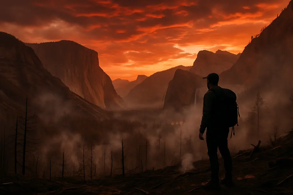
As of September 23, 2026, Dome Fire Yosemite planning requires close attention to official updates, smoke conditions, and trail closures near Wawona. Yosemite National Park has remained open, but the fire has affected a specific backcountry and trail area rather than the entire park. That distinction matters for travelers deciding whether to keep lodging, change hiking plans, or postpone a route that depends on the Chilnualna Falls area.
Dome Fire Yosemite Current Status
Dome Fire Yosemite Location And Growth
The National Park Service reported that the fire was discovered on September 15, 2026, about one quarter mile north of Chilnualna Falls, with an initial preliminary size near 100 acres and moderate spread to the north and northeast, according to the September 15 park update. Later park updates recorded significant growth: 2,335 acres by September 19 and about 2,667 acres by September 20, with containment still listed at 15 percent. By September 21, California travel-alert information citing CAL FIRE and the National Interagency Fire Center placed the fire at 3,047 acres, 15 percent contained, with no evacuation orders or warnings in effect, as reported in California travel alerts.
The available reports show a fire concentrated in steep terrain north of Chilnualna Falls, not a park-wide closure. The fire also moved toward the footprints of the 2017 Empire Fire and South Fork Fire. Park fire information indicated that those previously burned areas were expected to help slow growth because fuel had already been reduced. That does not remove risk, but it helps explain why officials distinguished between the fire area and developed visitor zones.
Resources Assigned To The Fire
For Dome Fire Yosemite planning, the operational details matter because they indicate a managed incident rather than a simple trail advisory. Crews have used ground resources, including hand line construction and hiking into steep terrain, along with aerial resources such as helicopters for water drops and crew transport. By September 20, 525 personnel were assigned. Structure protection groups were also positioned to be ready for Badger Pass, Wawona, and Yosemite West if needed. The park reported no immediate threats to infrastructure or developed areas in the available updates, but that status should be checked again before any departure because wind, smoke, and fire behavior can alter access quickly.
Access, Trail Closures, And Smoke Conditions
Closed Trails Near Chilnualna Falls
The most concrete visitor impact is the closure of the Chilnualna Falls Trail and trails from the top of Chilnualna Falls toward Buena Vista and Crescent Lakes. The park also noted that Buena Vista and Crescent Lakes remained reachable from the east. A safety closure area extended east of Wawona Road from Wawona to Chinquapin, based on park maps referenced in updates. Travelers should not treat the closure as optional: it exists to separate visitors from active fire operations, falling material, low visibility, and fast-changing conditions.
For hikers, the practical effect is straightforward. If a route uses Chilnualna Falls as the entry point, it should be replaced with a different plan. If a trip depends on reaching Buena Vista or Crescent Lakes, the eastern approach is the supported alternative noted in park information. Do not rely on older printed guidebooks, saved map screenshots, or previous trip reports for this part of the park during the incident period.
Smoke Exposure By Visitor Area
Smoke is the broader concern for visitors who are not entering the closure area. Park information in the research set described air quality as moderate in areas including Yosemite Valley, Hodgdon Meadow, and Tuolumne Meadows, while Wawona was experiencing levels unhealthy for sensitive groups, with some afternoon improvement. Smoke can also reduce visibility, softening long-distance views and making scenic overlooks less predictable.
Travelers with asthma, heart or lung conditions, older adults, and families with young children should weigh the Wawona smoke reports carefully. A trip can remain logistically possible while still being a poor fit for a person sensitive to smoke. Masks rated for particulate smoke, indoor breaks, and reduced exertion can help some visitors, but they do not make smoky air harmless. The most useful planning step is to check official air-quality and park updates on the morning of travel rather than assuming conditions from the prior evening still apply.
Trip Planning By Area And Timing

Yosemite Valley, Wawona, And Tuolumne Meadows
Yosemite National Park remained open and operating normally except for trails closed near the fire, according to the travel-alert information in the research. That does not mean every visitor will have the same experience. Yosemite Valley may be open while distant views are hazy. Tuolumne Meadows may be outside the main closure area while still seeing smoke on certain wind patterns. Wawona is the area that requires the closest read of smoke and access updates because the fire is near Chilnualna Falls and the closure area runs east of Wawona Road from Wawona to Chinquapin.
If you have lodging in or near Wawona, confirm cancellation terms, check whether your planned hikes are affected, and prepare a lower-exertion day plan. If you are staying in Yosemite Valley, the main question is less about direct fire access and more about visibility, smoke comfort, and whether your itinerary depended on south-side trailheads. Visitors who are still planning future Yosemite dates can also compare access rules and traffic patterns in Yosemite access planning for 2026, since fire conditions are only one part of a practical visit.
Road-Trip Flexibility
A fire near a major national park can affect travelers beyond park boundaries because many Yosemite trips are part of longer California or western U.S. road routes. It is wise to build flexibility into arrival times, food stops, and lodging decisions. If visibility is poor, a scenic-drive day may be less rewarding than a shorter walk, a rest day, or a route away from smoke. Travelers looking to extend their journey through this region might find additional insights with our network’s Baja focus available at Baja Times, though decisions regarding Yosemite fire conditions should still be based on official park and California emergency updates.
Dome Fire Yosemite Trip Decisions
Use a simple decision framework before entering the park: confirm that your planned trail is open, check whether your lodging area has smoke concerns, and verify whether any evacuation warnings have been added since the last official update you read. If your main objective is Chilnualna Falls, the supported answer is to change plans because that trail is closed. If your objective is elsewhere in the park, the question becomes whether smoke, visibility, and personal health factors make the visit worthwhile on your exact dates.
Treat Dome Fire Yosemite as a localized but active incident. The absence of evacuation orders as of the cited updates is useful information, not a promise that conditions will remain stable. Travelers should avoid the closure area, keep plans flexible, and make decisions from official daily updates rather than social posts or older itinerary notes. That approach protects both visitors and fire crews working in steep terrain near Chilnualna Falls.