

The Hawaiian archipelago exists as a direct result of continuous tectonic and magmatic activity. Unlike most global volcanic networks positioned along tectonic plate boundaries, the Hawaiian islands sit squarely in the middle of the Pacific Plate. This geographic isolation presents a unique geological case study. The continuous extrusion of magma from deep within the Earth dictates the physical shape of the islands, influences local weather patterns, and defines the exact parameters for human habitation and construction.
The Hotspot Theory And Island Formation
Geologists attribute the existence of the Hawaiian islands to a stationary mantle plume, commonly referred to as a hotspot. Deep beneath the ocean floor, an area of extreme thermal anomaly melts the surrounding mantle rock, generating highly pressurized magma. As the Pacific Plate slowly drifts northwest at a rate of roughly three to four inches per year, this stationary thermal plume continuously punches through the crust.
This sequential process creates a long, linear chain of islands. Kauai, located at the northwestern end of the main islands, represents the oldest major landmass, having moved away from the hotspot millions of years ago. Its topography shows extensive erosion and zero active volcanism. Hawaii, known as the Big Island, currently sits directly above the mantle plume. This specific positioning fuels ongoing eruptions and continuous land expansion. As the plate continues its slow drift, new submarine volcanoes, such as Lo’ihi, are forming southeast of the Big Island and will eventually breach the ocean surface thousands of years from today.
Shield Volcanoes: Structure And Eruption Dynamics
The distinct shape of Hawaii volcanoes comes directly from the chemical composition of their magma. These massive structures are classified as shield volcanoes. They feature broad, gently sloping profiles that resemble a warrior’s shield resting flat on the ground.
The magma beneath Hawaii holds a basaltic composition, meaning it is low in silica. This low silica content results in low viscosity. When the magma breaches the surface, it flows easily and travels great distances before cooling and solidifying. This fluid movement prevents the buildup of extreme internal pressure that causes the catastrophic, explosive eruptions typical of stratovolcanoes like Mount St. Helens.
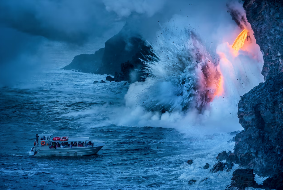
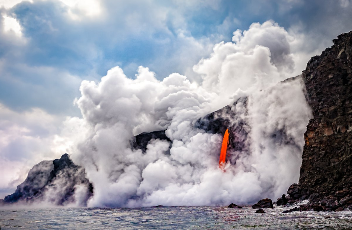
Eruptions in Hawaii are typically effusive. Lava steadily pours or fountains from vents and fissures, creating long rivers of molten rock that travel toward the coast. The surface texture of the cooled lava frequently falls into two distinct categories based entirely on flow dynamics. ‘Aa lava forms a rough, clinkery surface as a cooler, slower-moving flow fractures into jagged blocks. Pahoehoe lava, being hotter and much more fluid, cools with a smooth, billowy, or ropy surface.
Dominant Forces: Kilauea And Mauna Loa
The Big Island hosts five distinct volcanoes, with Kilauea and Mauna Loa representing the most active and geologically significant. Mauna Loa holds the designation as the largest active volcano on Earth by volume and area. Its massive physical presence heavily influences the island’s weather, creating vast rain shadows. Historically, Mauna Loa erupts with high-volume lava flows that can reach the ocean within hours or days of a summit breach.
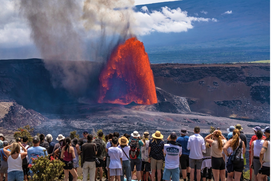
Kilauea, positioned on the southeastern flank of Mauna Loa, remains one of the most active systems on the planet. For decades, Kilauea maintained a nearly continuous eruptive state, reshaping the coastline and adding hundreds of acres of new land to the island. The 2018 lower Puna eruption showcased the destructive potential of this system. Massive fissure complexes opened in residential neighborhoods, displacing thousands of residents and completely altering the local topography.
| Volcano Name | Status | Prominent Characteristics |
| Mauna Loa | Active | Largest active volcano by volume; produces massive, fast-moving flows. |
| Kilauea | Active | Highly frequent eruptions; primarily effusive, capable of summit explosions. |
| Mauna Kea | Dormant | Highest peak in Hawaii; hosts major astronomical observatories. |
| Hualalai | Active | Last erupted in 1801; steep slopes compared to other shield formations. |
| Kohala | Extinct | Oldest volcano on the Big Island; heavily eroded with deep valleys. |
Atmospheric Impact And Ecological Succession
The continuous output of volcanic gases fundamentally alters the local atmosphere. Eruptions release massive quantities of water vapor, carbon dioxide, and sulfur dioxide. When sulfur dioxide reacts with sunlight, oxygen, dust, and atmospheric moisture, it forms volcanic smog, widely known as vog. Vog creates a persistent haze that degrades air quality, affecting agricultural yields and human respiratory health downwind of active vents.
Following the immediate destruction caused by lava flows, these geological events initiate a swift process of ecological succession. Fresh lava fields initially present a sterile, hostile environment. Within months, specialized pioneer species begin to colonize the cooling rock. Ferns and ‘Ohi’a lehua trees root in tiny cracks where moisture accumulates. The breakdown of the basaltic rock, combined with accumulating organic matter, slowly generates highly fertile soil, eventually supporting dense tropical forests. The cycle of destruction and rebirth operates continuously.
Constructing Resilience In Volcanic Hazard Zones
Human habitation on the Big Island requires a highly calculated approach to risk management. The United States Geological Survey divides the island into nine distinct Lava Flow Hazard Zones, with Zone 1 representing the highest risk. These strict designations heavily influence property values, insurance rates, and local building codes.
Constructing residential structures in or near these active zones demands precise architectural and engineering responses. Traditional building methods frequently fail when subjected to the extreme realities of volcanic proximity. Seismic activity frequently accompanies magma movement beneath the surface. Homes built in these areas require heavy structural reinforcement. Builders utilize specialized foundation anchoring systems and flexible framing techniques designed to absorb kinetic energy without catastrophic failure.
The topography created by ancient lava flows presents unique site planning challenges. Building on a cooled ‘Aa flow requires extensive site preparation. Heavy machinery must crush the jagged rock to create a level building pad. Conversely, building on Pahoehoe flows often allows architects to incorporate the natural, undulating rock formations into the hardscaping or structural foundation of the home. Custom homes in these regions frequently feature raised post-and-pier foundations. This elevation minimizes the need for extensive excavation, preserves the natural volcanic terrain, and protects the structure from localized flooding during heavy tropical downpours.
Building materials must resist highly corrosive environmental factors. The high sulfur content in the air and acidic rain quickly degrade standard metals and wood finishes. Stainless steel fasteners, specialized architectural coatings, and heavily treated timber are mandatory for structural longevity. Designing homes that can withstand harsh natural elements yet maintaining their aesthetic and functional integrity is a core principle in modern custom home building. The structural demands of living near an active volcano simply amplify the need for precise engineering and material selection.
Air Quality Management And Off-Grid Independence
Mitigating the effects of vog heavily influences interior layout and HVAC design. Homes situated downwind of Kilauea frequently utilize advanced air filtration systems. High-efficiency particulate air filters and activated carbon systems strip sulfur compounds from incoming air, maintaining safe indoor air quality during heavy vog events.
The constant threat of lava severing access to municipal utilities drives many residents toward complete off-grid independence. Solar arrays with heavy battery storage capacities provide reliable electricity when municipal electrical lines fail. Rainwater catchment systems act as the primary water source for many rural properties, utilizing large roofs to collect precipitation, which is then filtered and sterilized for domestic use. This push for self-sufficiency changes the architectural footprint of the property, requiring dedicated space for infrastructure that is typically hidden or outsourced in standard suburban developments.
Geological Monitoring And Future Planning
Predicting volcanic behavior remains a complex scientific challenge, yet continuous monitoring provides fundamental data for public safety. An extensive network of seismometers, GPS receivers, and tiltmeters tracks the slightest deformations in the earth’s crust, indicating the movement of magma below.
Reviewing the live data and threat assessments provided by the USGS Hawaiian Volcano Observatory offers direct insight into the current state of tectonic activity. This real-time information dictates emergency response protocols and long-term zoning regulations. As the magma chambers shift and the Pacific Plate continues its slow march over the hotspot, the topography of Hawaii will continue to transform. Architects, urban planners, and residents operate with the knowledge that the ground beneath them remains a dynamic, active force, requiring constant adaptation and deep respect for the geological mechanics at play.